 |
 |
 |
 |
| Polarboard OSB is made in Fort Nelson from
poplar logs like these. |
More views of the wilderness between Fort St.
John and Fort Nelson. |
Seems a likely place to spot a moose. |
The mist hung over the banks of the Peace
River as we descended toward our crossing. |
 |
 |
 |
 |
| The Peace River Bridge. The earth
structure on the near side was built after a disgruntled employee caused
the original wooden approach structure to burn to the ground. |
Look carefully, and you can see our Budd
car's shadow on the Peace River. |
A photo run by with magnificent fall colors
everywhere. |
Climbing up out of the Peace River on the
South side. |
 |
 |
 |
 |
| We arrive in Dawson Creek at the old Northern
Alberta Railway (NAR) depot. The grain elevator has been restored
into an art museum. |
Here's where the Alaska Hiway starts. |
Several thoughtful Canadians left flowers and
notes honoring those lost in the September 11 terrorist attacks. |
A large beaver pond in this lake we passed
returning from Dawson Creek. |
 |
 |
 |
 |
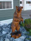
| We spent the night in Chetwynd. The
town has numerous chainsaw carvings on public display. This one was
right outside our dinner house. |
In a couple of the small towns we visited, a
group of 70 people put a serious strain on the local hospitality
industry. This restaurant was closed to the public so they could
serve us. Local council members joined us for dinner and talked
about their district. |
We arrived into Chetwynd about an hour and a
half later than expected. A tour of the local chainsaw carvings had
to be done after dark. |
Our local hosts went all out to show us the
town, its carvings, and museum. |
 |
 |
 |
 |
| We explored a little more of Chetwynd early
the next morning, when we had a little daylight. Mo is shivering in
front of "City Hall", with some nice chainsaw carvings out
front. |
City Hall |
City Hall |
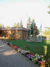
Also on the grounds of City Hall |
 |
 |
 |
 |
| Most of our mornings included early
departures. Mo was glad to get home so she could sleep in past 5AM. |
We had great open scenery on our trip into
Tumbler Ridge |
The sheer magnitude of the mining operation
here is hard to appreciate. Look carefully at the top of this
mountain, nearly all of which has been mined for coal. |
Plenty of color at Tumbler |
 |
 |
 |
 |
| We stopped into the bar at the Fort St. James
Hotel for a beer on our walk home after dinner. An interesting
experience. The bar is officially called "The Zoo", for
reasons we now understand. |
A gorgeous morning along the lake in Fort St.
James. This is taken from a city park on the shore. |
City Hall, with more colorful flowers and a
logger sculpture. Note the flags are at half-mast. |
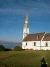
Our Lady of Good Hope church sits peacefully
on the shore of the lake. |
 |
 |
 |
 |
| We walked along the lake to explore the
church. |
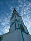
Artsy-craftsy shot up the steeple. |
After breakfast, we toured the National
Park. Fort St. James was a Hudson's Bay Co. trading post.
Here, we're exploring the fur warehouse. |
The grounds of the Fort. |
 |
 |
 |
 |
| The mercantile. The local guides were
very knowledgeable about the Fort and its history. |
We stopped at this trestle for a photo
stop. I started to get out of the car, but quickly realized I wasn't
going to be able to walk on the grated trestle deck without freezing. |
So I photographed the trestle from the safety
of the Budd car! |
Our car stopped at this crossing to let us
out so we could walk to the Painted Chasm viewpoint. |
 |
 |
 |
|
| Painted Chasm |
The colors are vibrant in the wall of the
Chasm. |
The rail route down the Fraser River Canyon
is stunning. I have lots of good video of this route, which winds
through very open country down from Kelly Lake into Lillooet. On the
far side of the river, you can see ginseng crops. |
|